“パリ15区、グレネル大通り❦ Paris XVe boulevard de Grenelle” has been added to your cart.
Continue shopping
“Poetische Meisterschaft von Browning❦ Poetical Works of Robert Browning 1896 binding Bumpus” has been added to your cart.
Continue shopping
“SIMCA. Votre Simca 1000 tous types. Le seul guide technique et pratique 1966” has been added to your cart.
Continue shopping
“ホーファー版画入り聖書図像集❦ BIBLE Images bibliques. – Illustrations d’André Hofer” has been added to your cart.
Continue shopping
“法国建筑思想之书❦ architecture Hallopeau le livre de raison de l’architecture 1949” has been added to your cart.
Continue shopping
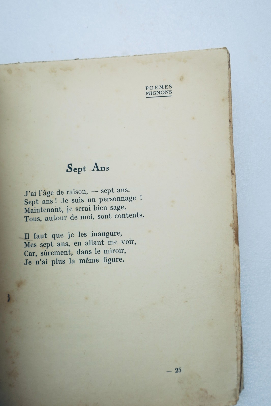
«Lucie Delarue-Mardrus Poèmes mignons pour les enfants» a été ajouté à votre panier.
Poursuivre les achats
“1889年パリ万博黄金の書❦ exposition 1889 EIFFEL Livre d’Or de l’Exposition” has been added to your cart.
Continue shopping
“ギデとヴァレリーの書簡❦ Gide, André Valéry, Paul CORRESPONDANCE: (1890-1942) SP” has been added to your cart.
Continue shopping
“Praktischer Holzbearbeitungsleitfaden❦ MENUISERIE Guide pratique du bois. Comment travailler son bois ?” has been added to your cart.
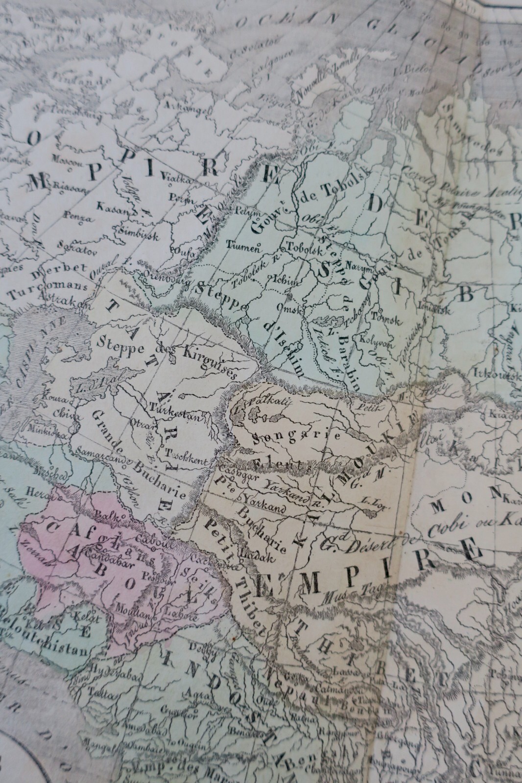
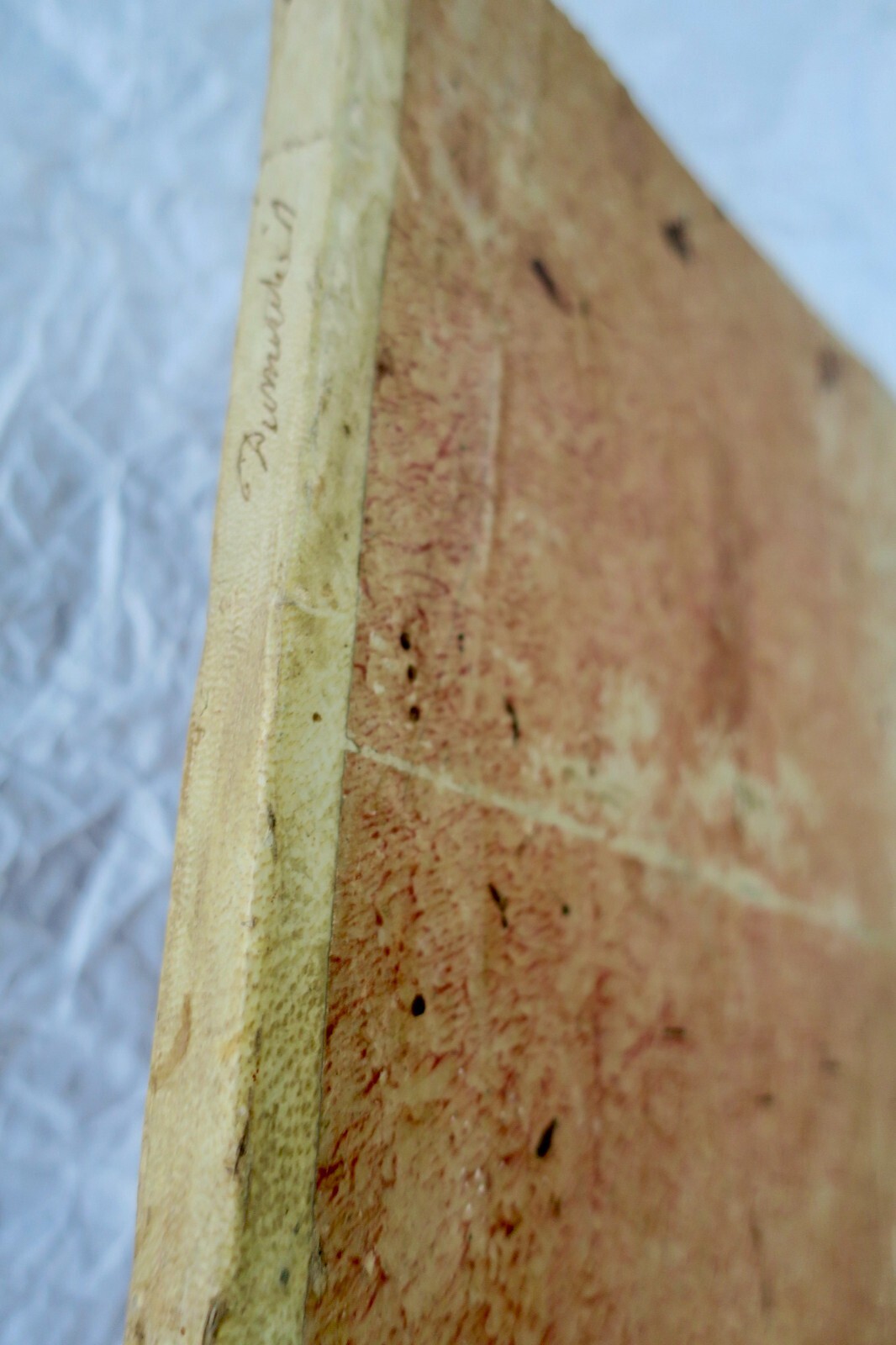
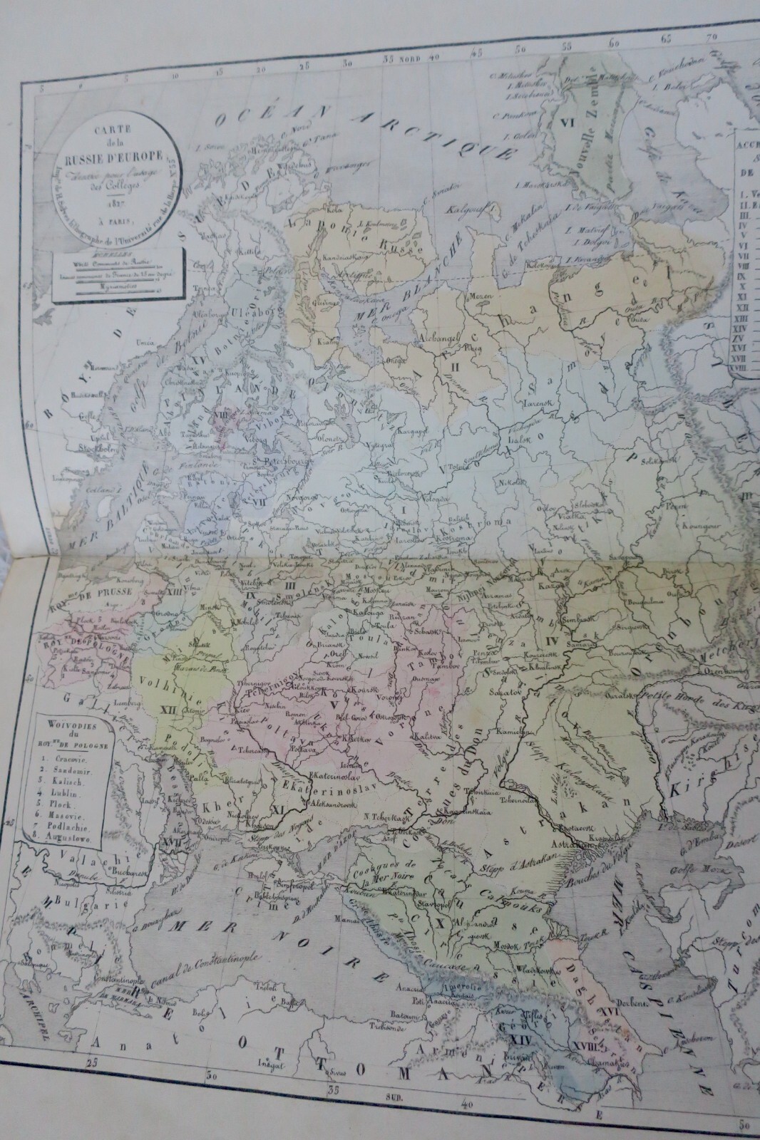
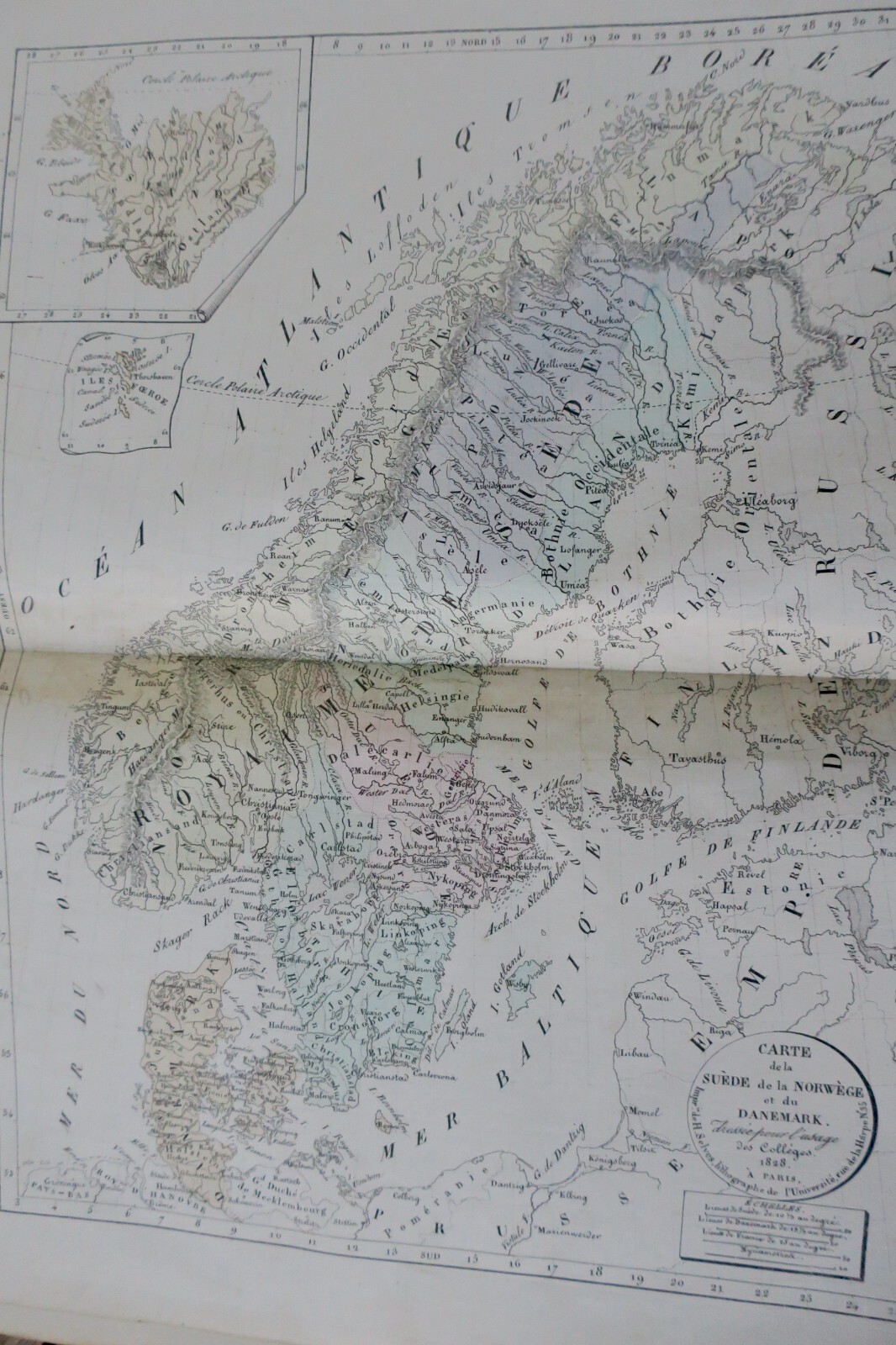
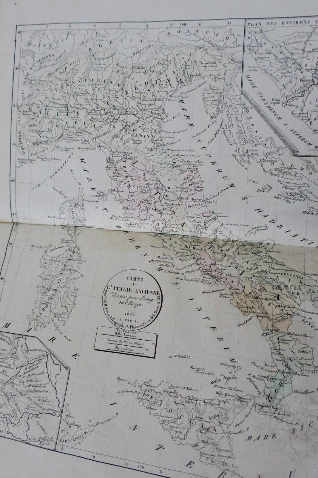
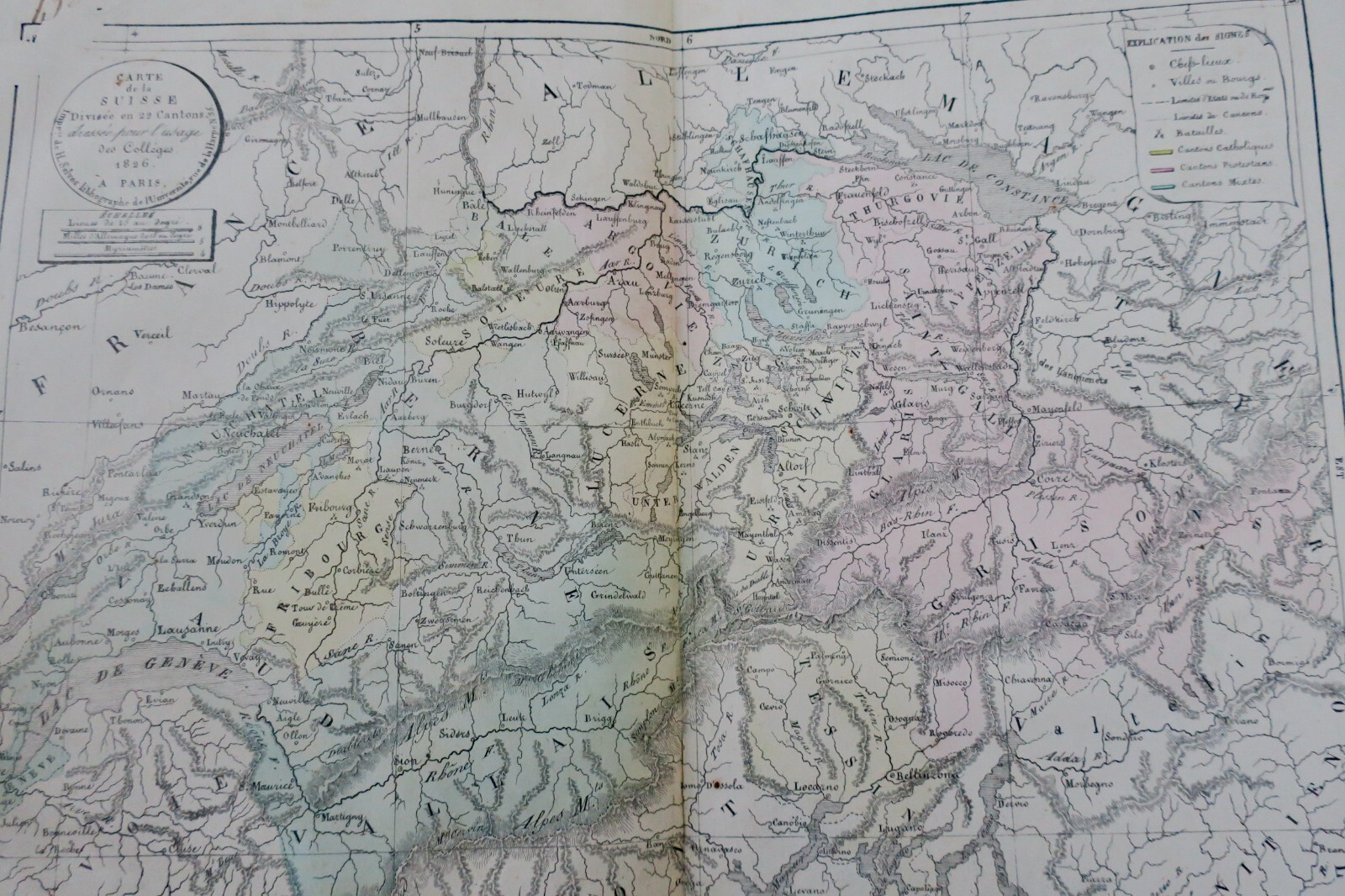
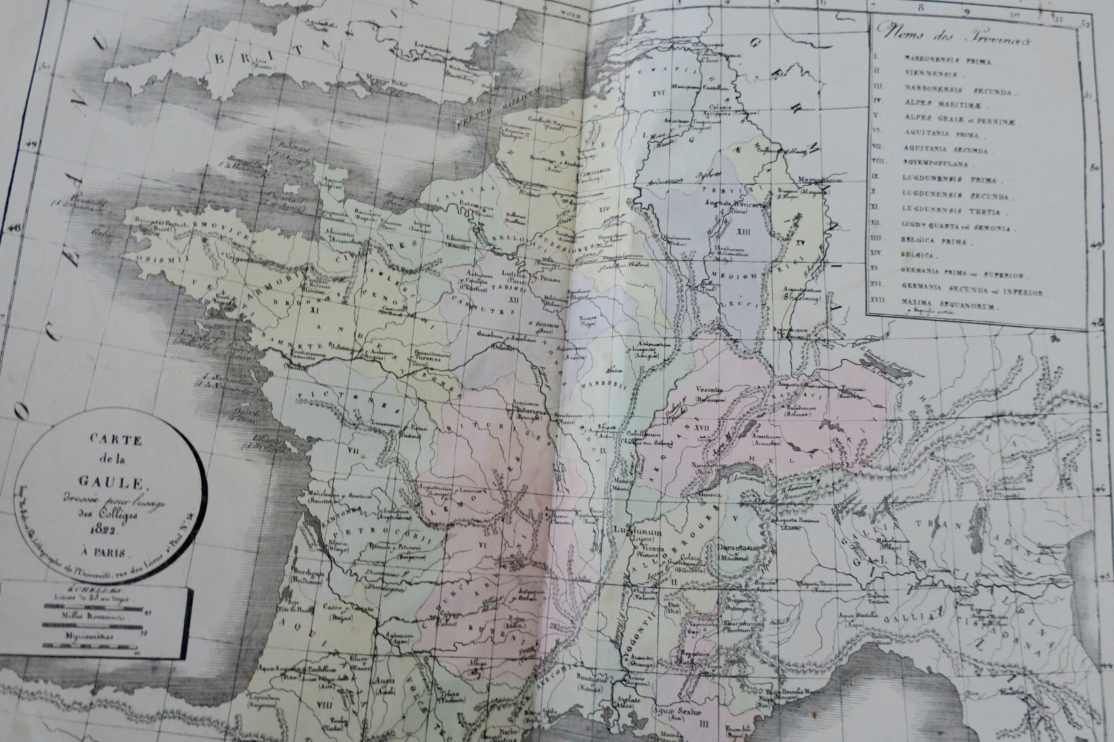
Continue shoppingRoyal geographical atlas for colleges, 1826
Original title : Atlas géographique dressé sous la direction du conseil royal 1826
306,00€
In stock
About this book
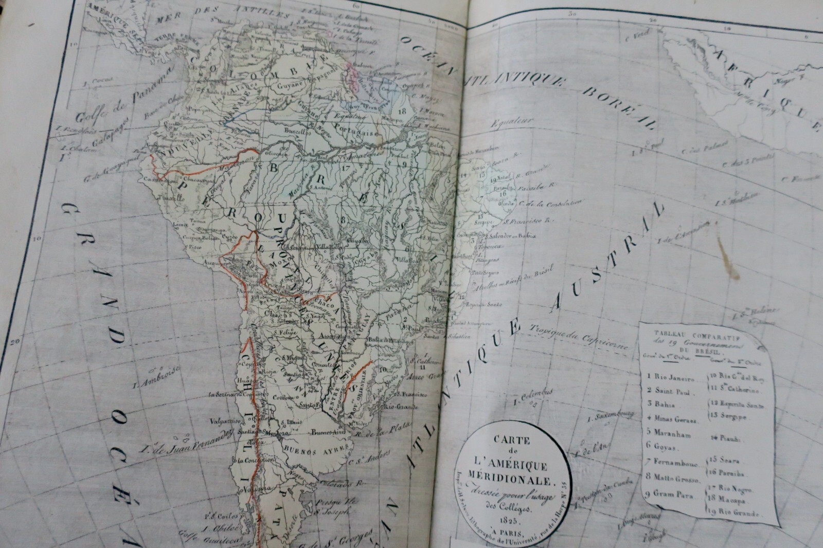
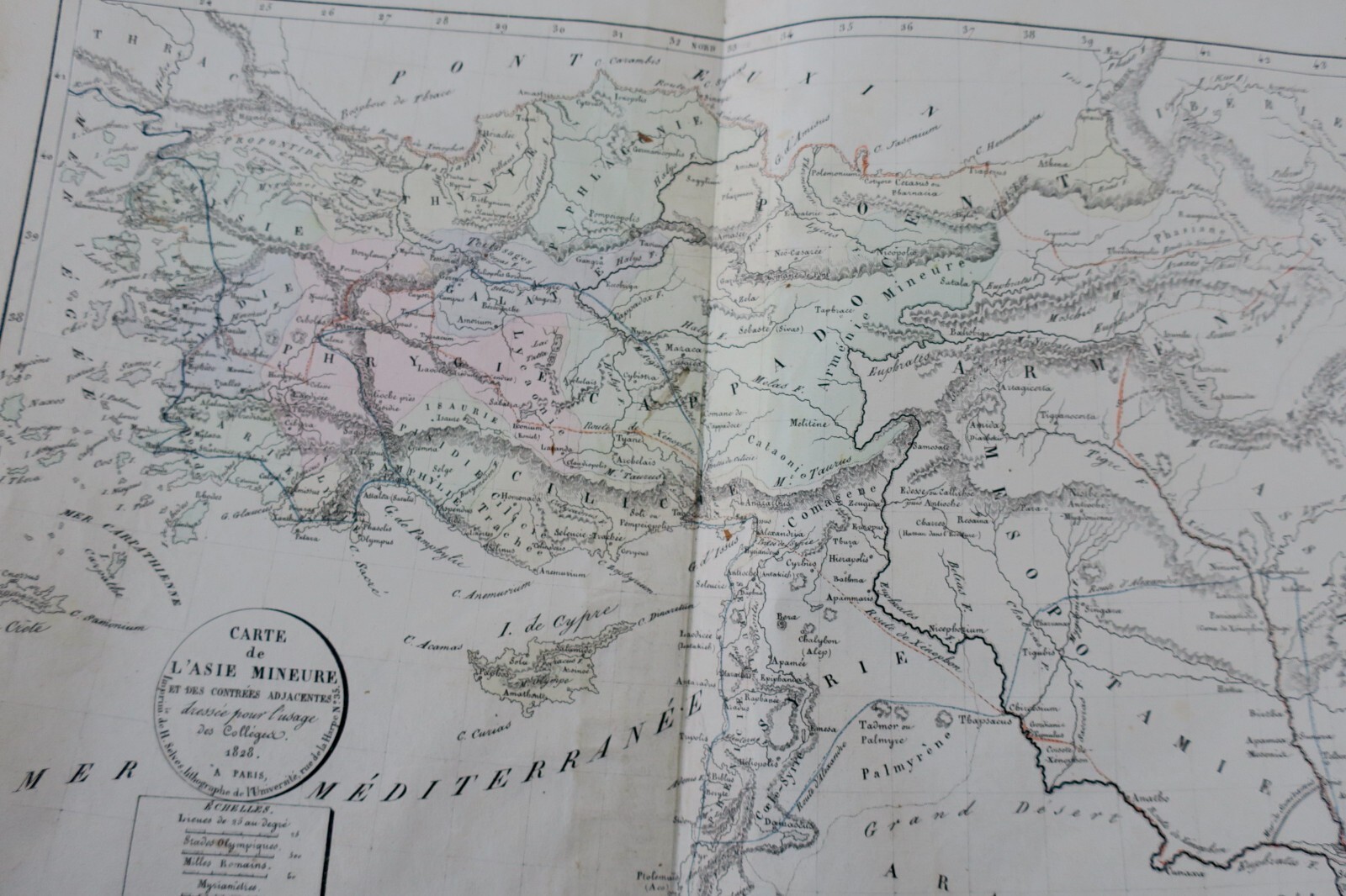
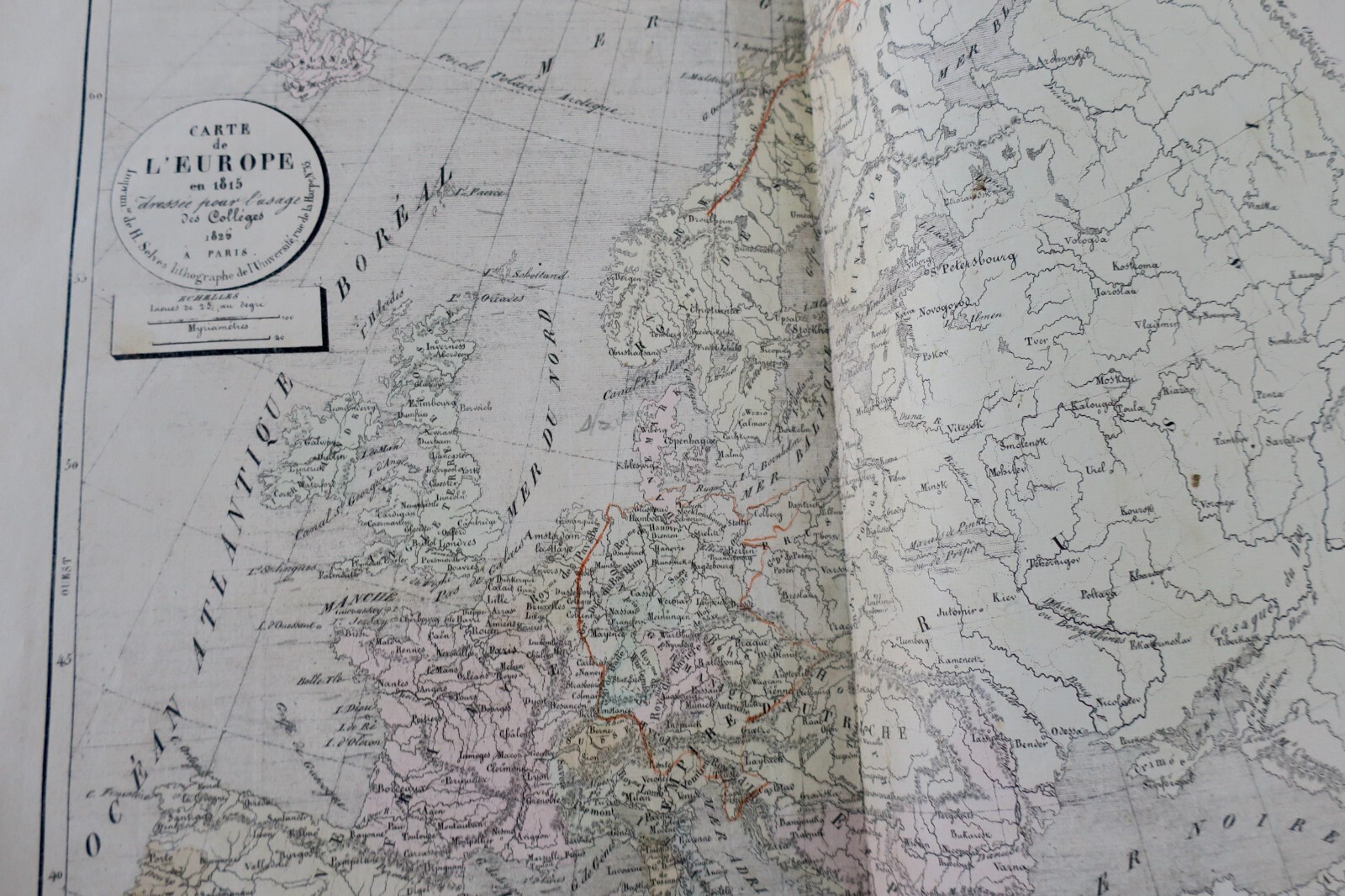
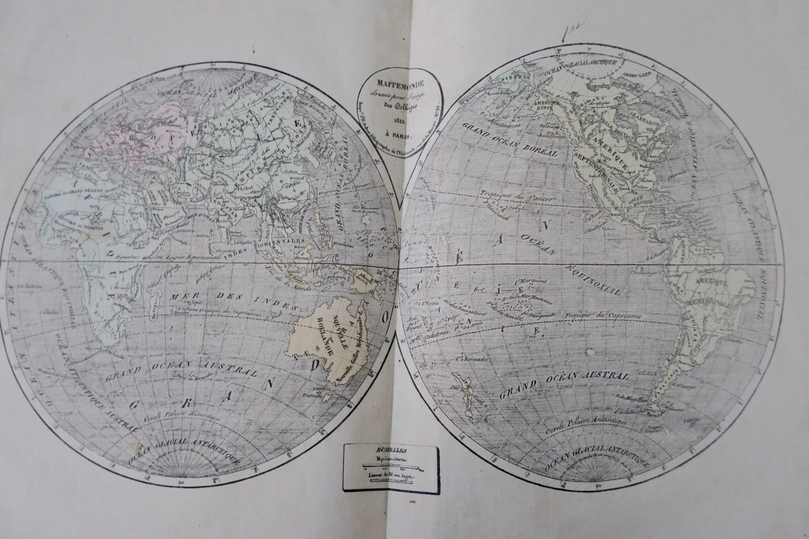
Geographical atlas prepared under the direction of the royal council for public education. Paris, Selves fils, 1826, 39 x 26 cm. Half vellum binding (somewhat worn), interior well preserved. For use in colleges. Work adopted for public instruction. Third part: current modern geography containing world map, Europe, Asia, Africa, North America, South America, France by department, Netherlands, Germany, Switzerland, Italy,…
Read full description ↓Description
Geographical atlas prepared under the direction of the royal council for public education. Paris, Selves fils, 1826, 39 x 26 cm. Half vellum binding (somewhat worn), interior well preserved. For use in colleges. Work adopted for public instruction. Third part: current modern geography containing world map, Europe, Asia, Africa, North America, South America, France by department, Netherlands, Germany, Switzerland, Italy, Spain and Portugal, British Isles, Sweden and Denmark, European Russia, European Turkey. First edition. Atlas of 20 double maps mounted on stubs.
❦
LA LIBRAIRIE ANTIQUE
Independent bookshop since 1995, Paris
Worldwide shipping · SLAM membership pending[*]
[*] Membership of the Syndicate of Antiquarian and Modern Booksellers in progress.