1 269,00€
Subtotal: 1 269,00€


Subtotal: 1 269,00€

Subtotal: 1 269,00€


188,00€
In stock
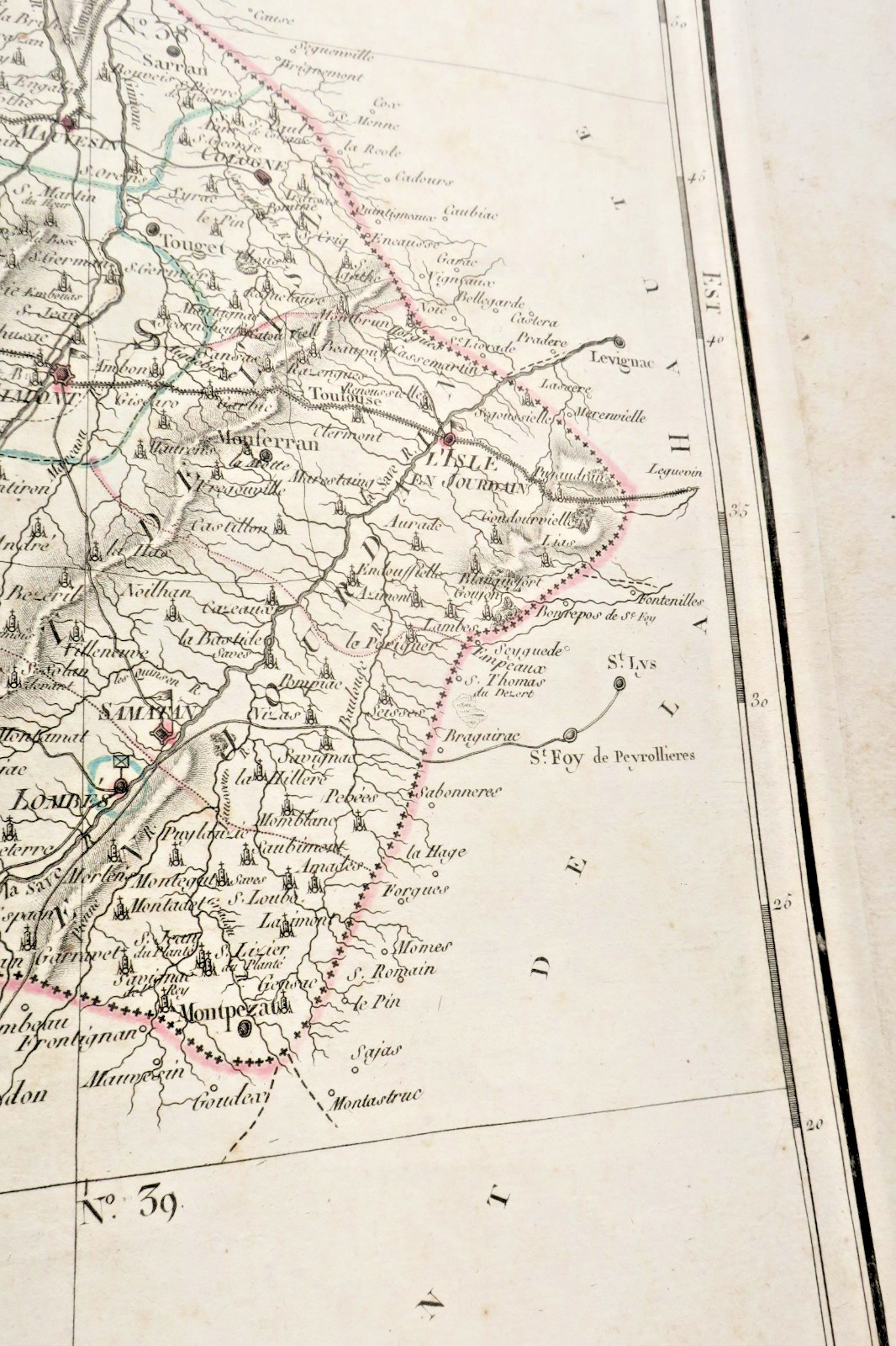
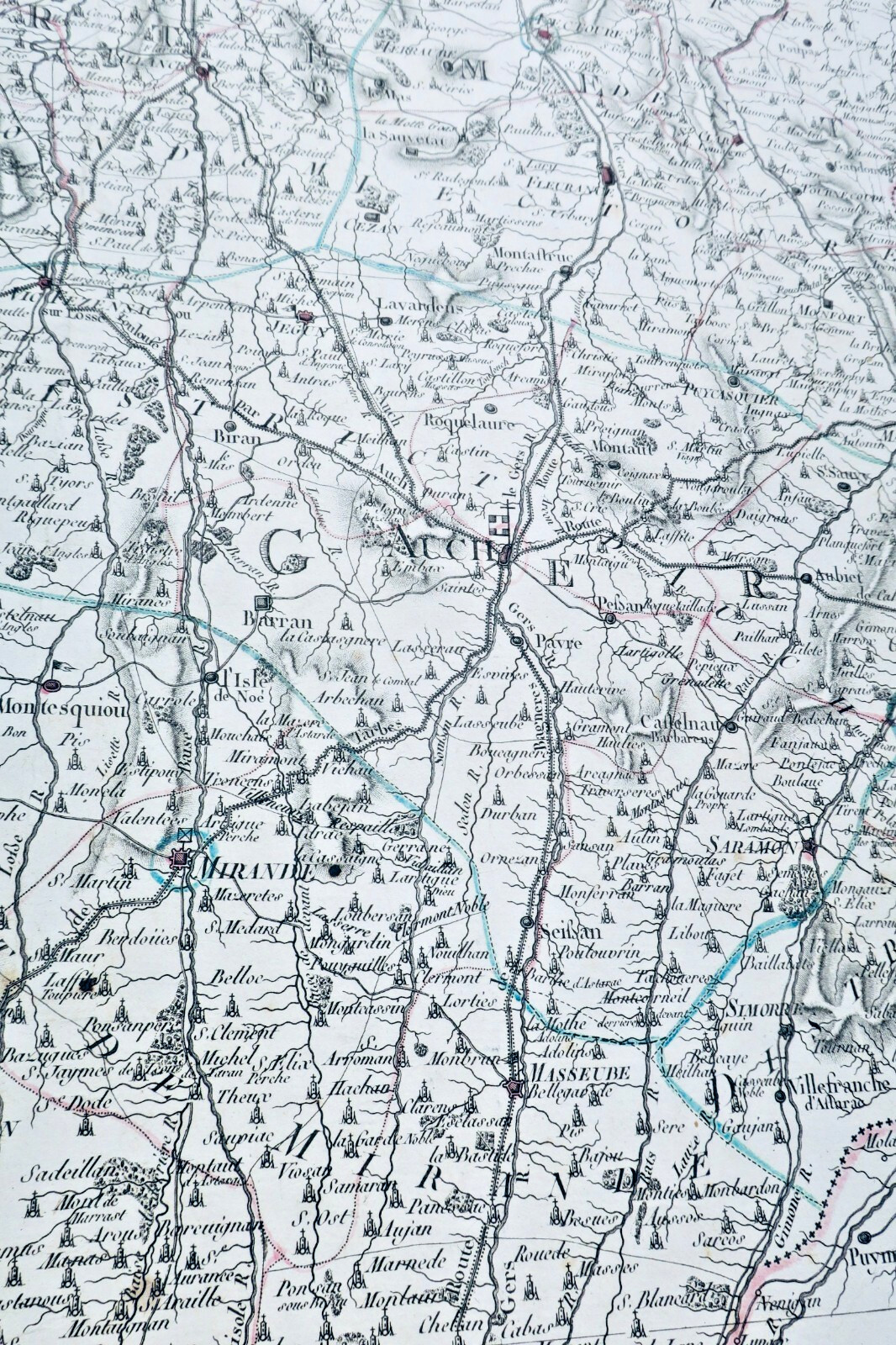
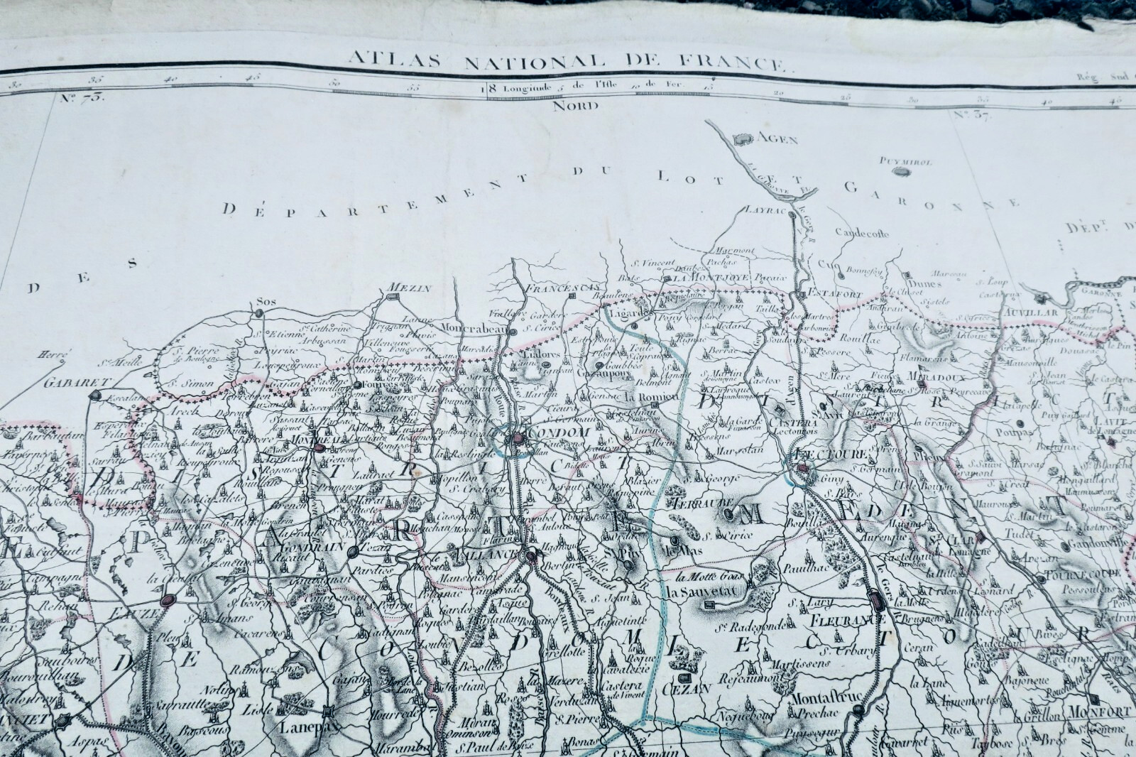
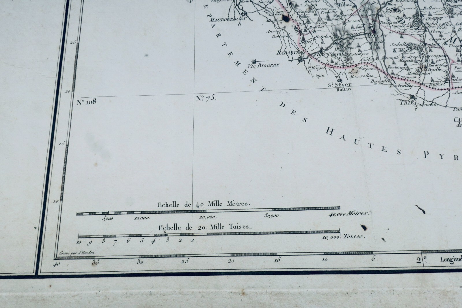
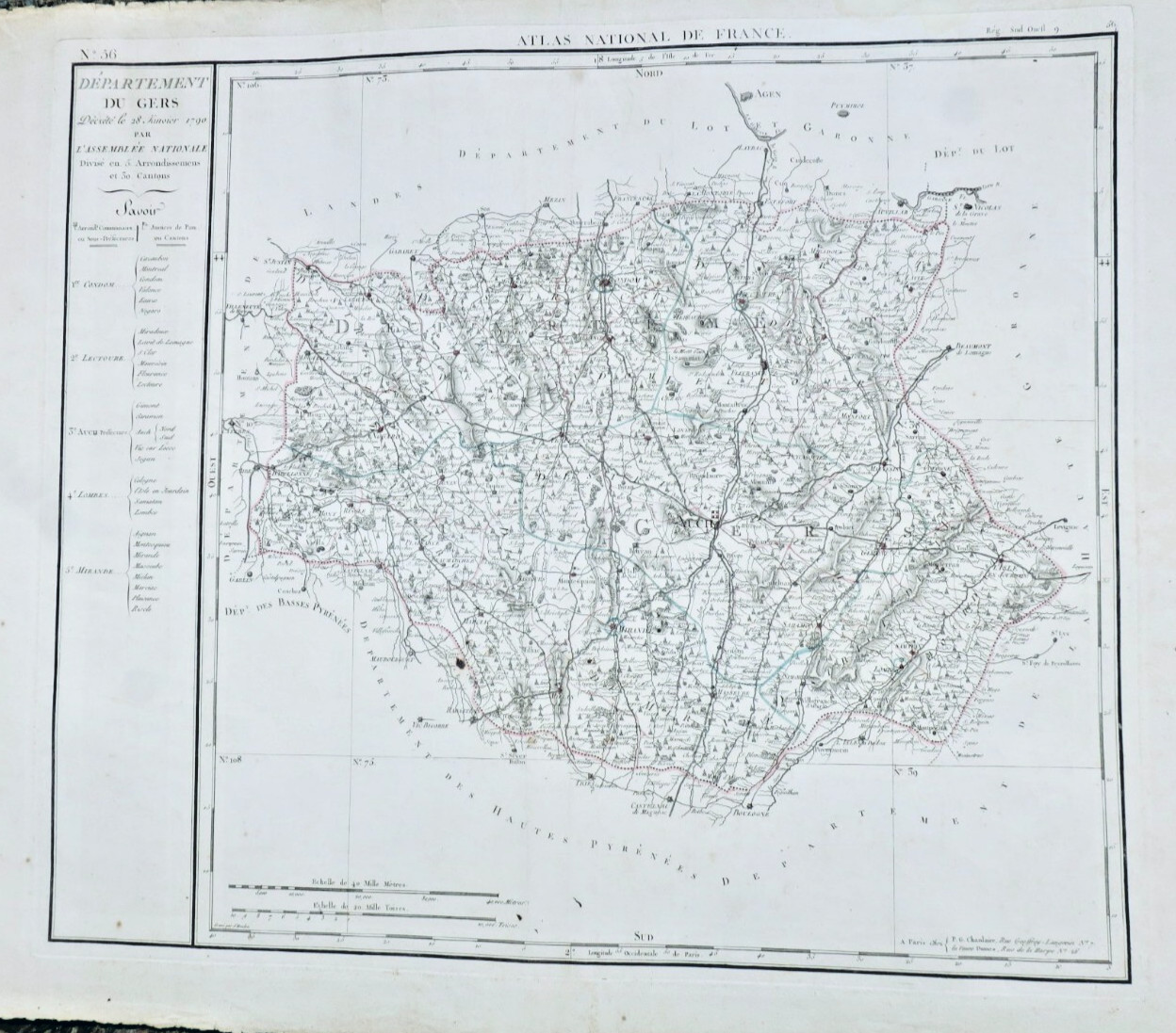
Department of Gers decreed on January 28, 1790 by the National Assembly. Paris, P.G. Chanlaire and Widow Dumez, engraved by Houdon, 590 x 860 mm (edge to edge). First printed map of the Gers department, engraved by François d'Houdan for the Atlas National de France, divided into 5 arrondissements or sub-prefectures, and 29 cantons or justices of the peace. Auch,…
Read full description ↓
LA LIBRAIRIE ANTIQUE
Independent bookshop since 1995, Paris
Worldwide shipping · SLAM membership pending[*]
[*] Membership of the Syndicate of Antiquarian and Modern Booksellers in progress.
Select at least 2 products
to compare