1 701,00€
Subtotal: 1 701,00€


Subtotal: 1 701,00€

Subtotal: 1 701,00€


VENDU
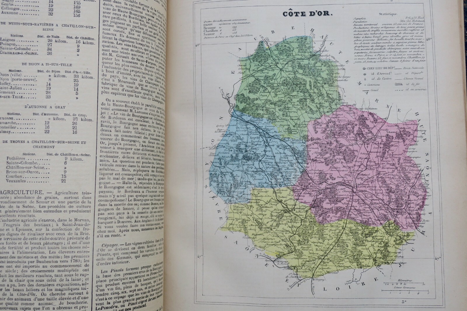
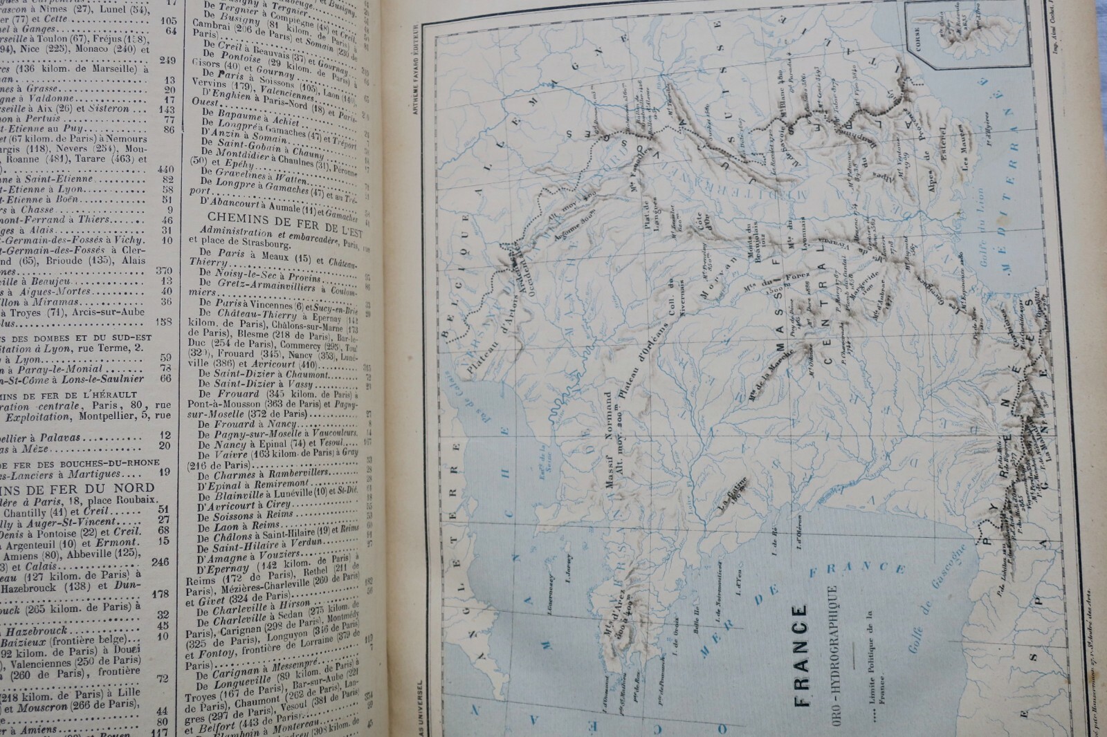
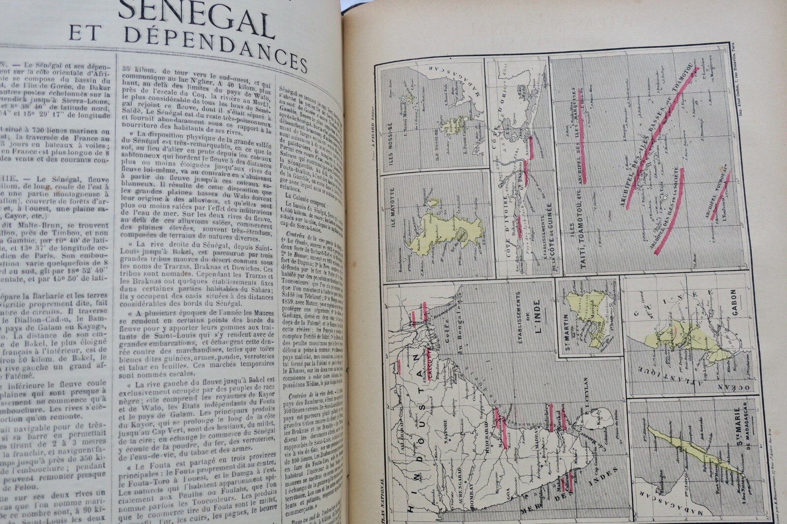
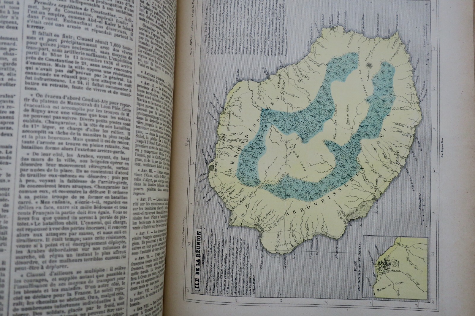
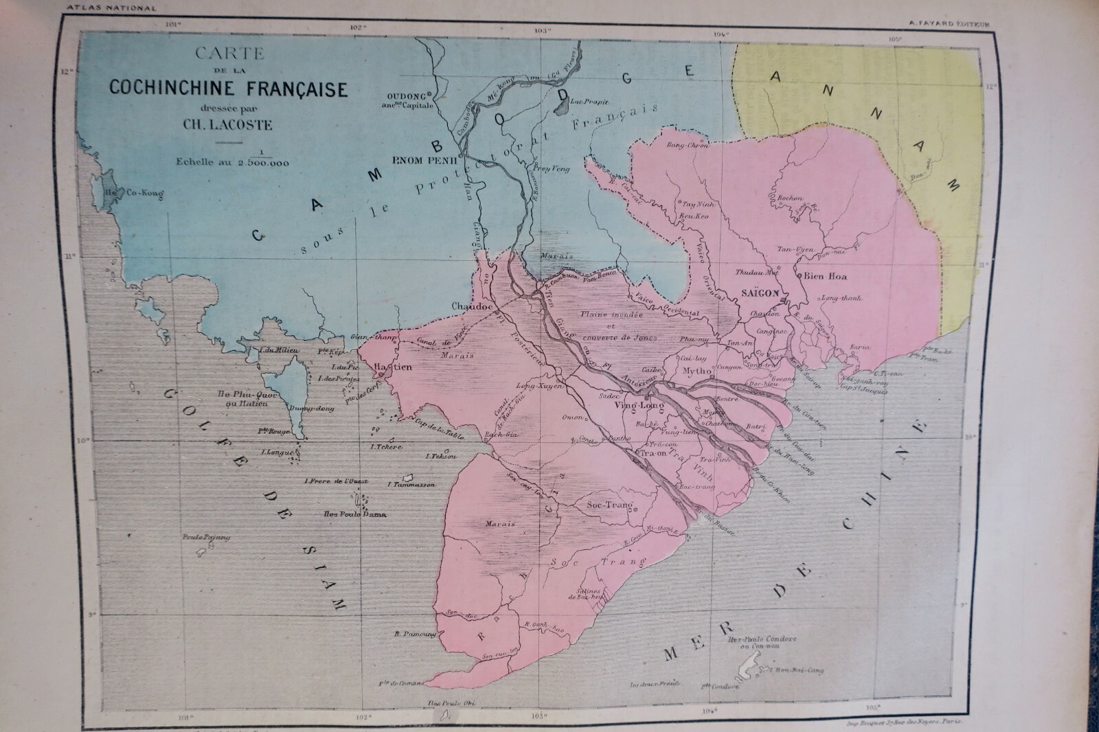
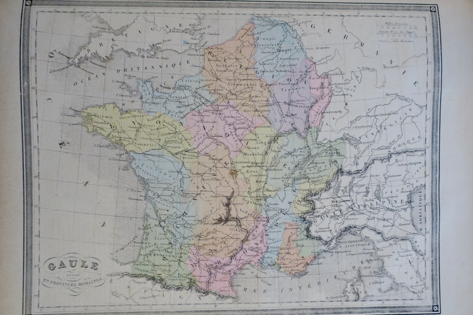
National Atlas of France (title page missing). Arthême Fayard, 1877. 125 colored maps, sometimes double-page spreads, covering stars, Europe, Gaul, France, departments, cities, and colonies. Half-leather binding with wear marks. 33 x 26 cm, 500 pages. Interior in good condition. Shipping outside the European Union incurs additional charges.
LA LIBRAIRIE ANTIQUE
Independent bookshop since 1995, Paris
Worldwide shipping · SLAM membership pending[*]
[*] Membership of the Syndicate of Antiquarian and Modern Booksellers in progress.
Select at least 2 products
to compare