0
0,00€
An empty cart
You have no item in your shopping cart


275,00€
In stock
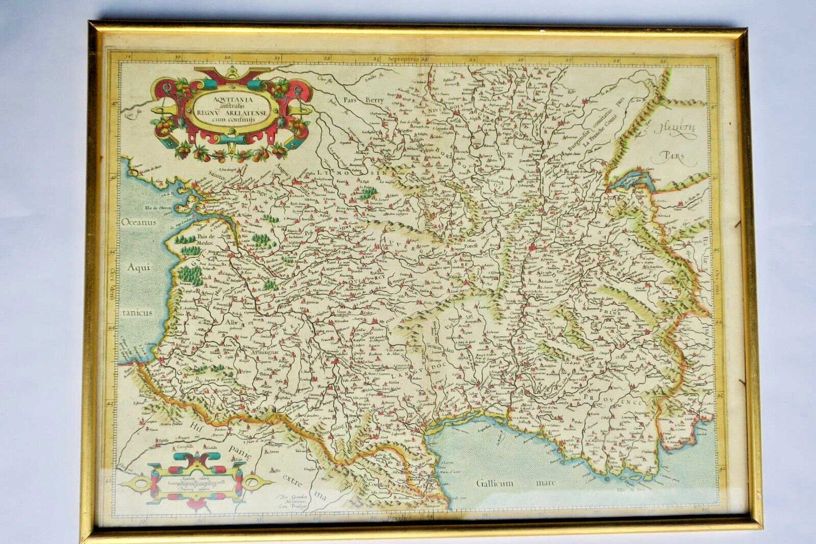
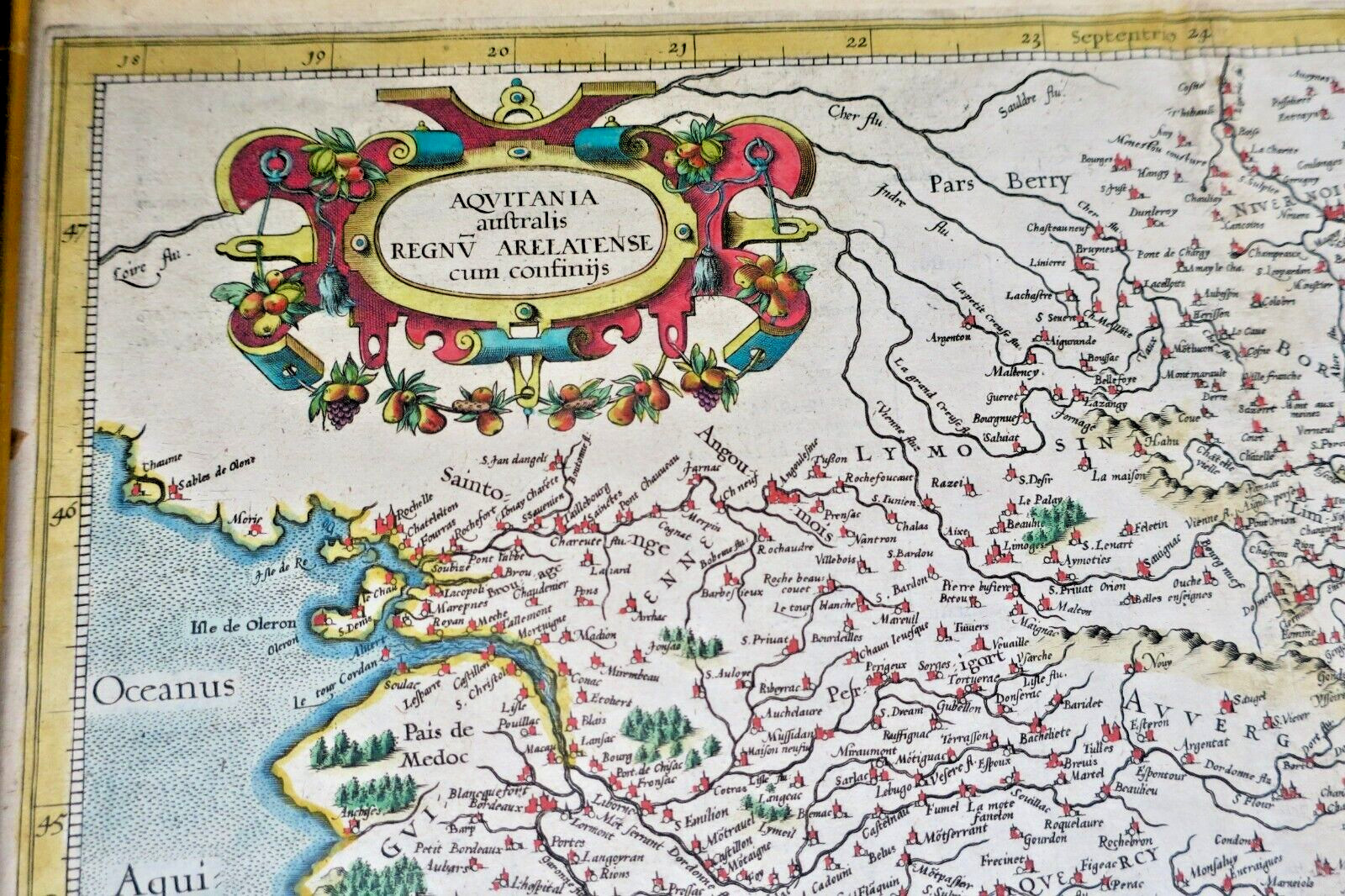
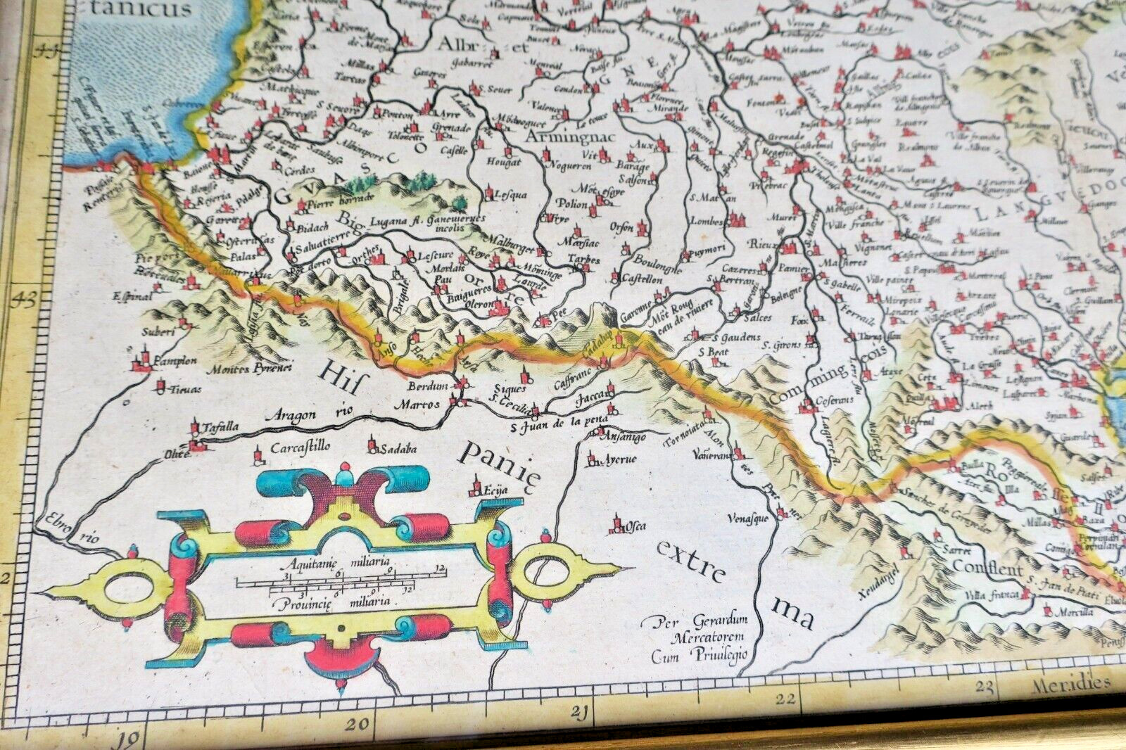
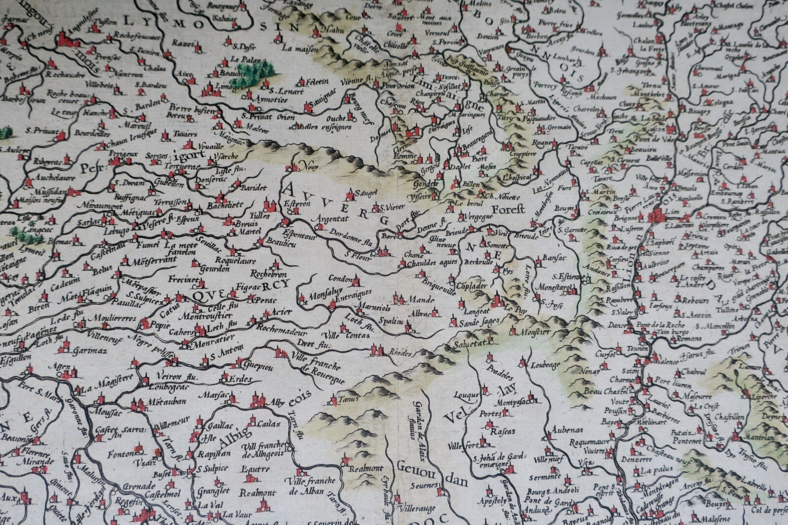
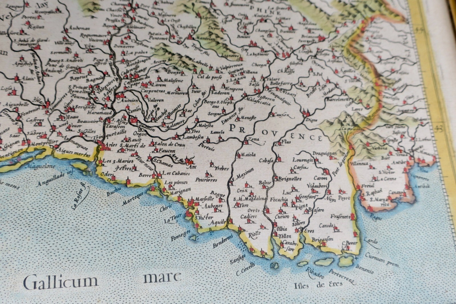
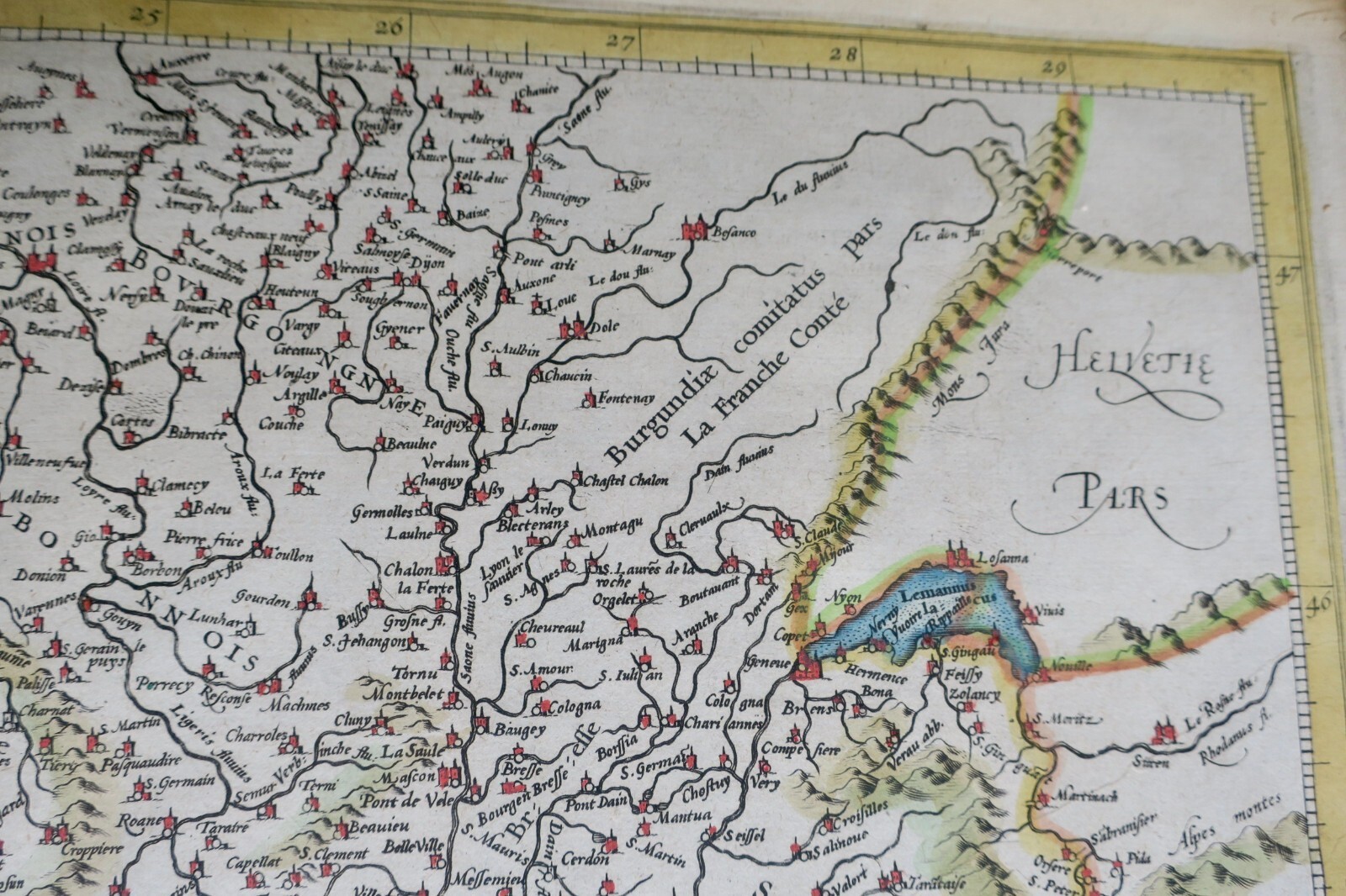
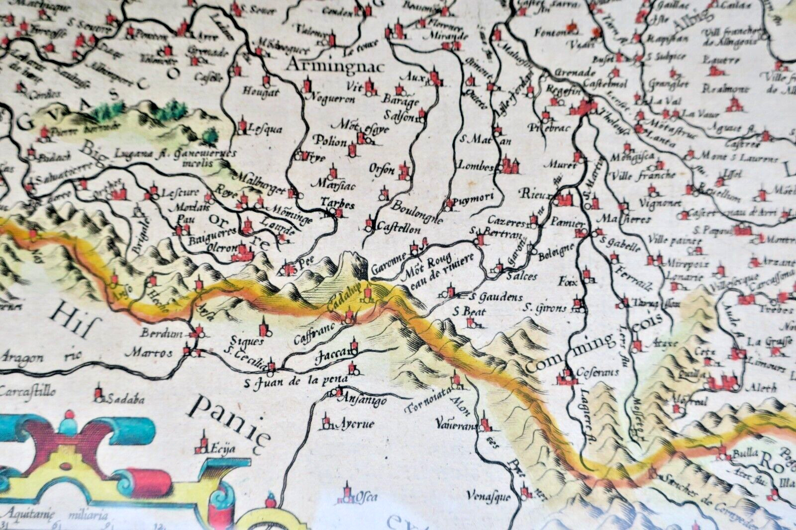
MERCATOR (Gerard) & Hondius Hendrik
Aquitania australis regnu arelatense cum confiniis. Per Gerardum MERCATOREM.
[Amsterdam. Carte en couleurs, taille du carte sous verre 50×38,5 cm, légendée, montagnes figurées, 2 cartouches, texte en latin, de la partie sud de la France allant d’ Auxerre au Nord Est à Monaco au nord de l’Espagne au Sud-Ouest, et aux Sables d’Olonne au Nord Ouest.
LA LIBRAIRIE ANTIQUE
Librairie indépendante depuis 1995, Paris
Expédition mondiale · en cours d'adhésion SLAM[*]
[*] Adhésion au Syndicat de la Librairie Ancienne et Moderne en préparation.